The Eye of the Sahara in Mauritania: Formation & Geology
The Eye of the Sahara in Mauritania: Formation & Geology
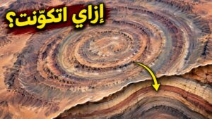
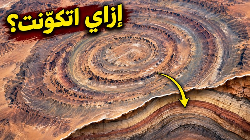
Look at this image from orbit: concentric circles surrounding a single center in the middle of the Mauritanian desert. This is the Richat Structure, commonly known as the ‘Eye of the Sahara.’ Spanning a diameter of approximately fifty kilometers, this massive geological landmark has puzzled scientists and sparked myths for decades.
Navigate Content
From Orbit to the Ground: Perceiving the Giant Rings
From above, the rings appear cohesive; from the ground, it is much harder to perceive the entire pattern with the same clarity. This is why NASA describes the Richat Structure as a prominent landmark that catches the eye of astronauts. The boundary that your eye easily traces across the screen is not a thin line drawn on the sand; it is a border between parts of a vast geological formation. When you are on the ground, you see only a portion of the terrain, but from orbit, the interrelation of these parts becomes apparent. This is precisely how the location earned its comparison to an eye. In satellite imagery, color also tells a story. Some images may use color enhancement or combine different light bands to highlight surface variations, helping scientists read the topography.
Rejecting the Impact Crater Theory
Before the myth of the city, the circular shape raised another possibility: that it might be an impact crater. In 1969, a geological study was published about the Richat Structure and another dome called Semsiyat, rejecting the notion that the Richat Structure was formed by an impact from space. Thus, this possibility was investigated and dismissed early on. Researchers had to find an explanation that linked the rings to the actual rocks present, examining what happened to the strata and how they reached the configuration we see today. For those interested in how structural anomalies are analyzed, you might appreciate exploring other natural phenomena like The Coelacanth Mystery: The Fish That Escaped Extinction.
The Geological Dome and Differential Erosion
Let us imagine a cross-section: rock layers whose central portion uplifted, causing the strata to arch upward into a broad dome. Over time, erosion wore away the elevated areas and exposed different levels of the strata.
- Not all rocks resist erosion to the same degree.
- Some parts remain prominent, while others erode more extensively.
- When we look down upon these curved layers, their boundaries appear as rings surrounding the center.
Consequently, the regularity of the circles can result from the geometry of the strata and their differential erosion, without anyone having planned them.
Magmatic Activity, Breccia, and Hydrothermal Karstification
However, the center holds another detail: breccia, a rock composed of broken rock fragments held together in a matrix. A 2005 study linked the dome and the central breccia to an underlying accumulation of alkaline igneous rocks, dating it to the Cretaceous period. Hydrothermal activity played a major role, with hot water circulating within the rocks and causing dissolution. The study described this dissolution process at the summit of the dome as hydrothermal karstification, adding chemical alteration to the physical removal of surface material. A subsequent 2014 study further reinforced this by identifying multiple types of igneous rocks within the structure.
Testing the Atlantis Hypothesis
Now we can return to the Atlantis claim and test the basis upon which it rests. The association between the Eye of the Sahara and Atlantis is a circulating modern hypothesis. While the concentric circles in the satellite imagery may remind observers of ancient descriptions of a lost metropolis, empirical geological evidence firmly grounds the structure in natural magmatic, tectonic, and erosional processes. To explore more about how misunderstood phenomena are unraveled, take a look at Did 2,000 Ships Sink at Once in Alexandria? Seafloor Evidence Revealed.
Frequently Asked Questions
Generated by AI Content Architect
About The Author